About this walk
The walk described below starts at the Great Northern in Langley Mill and finishes in Kimberley. However, the start and finish points are interchangeable and you can easily get there by a variety of bus services. There’s also a mainline railway station in Langley Mill providing access by train from Ilkeston or Nottingham.
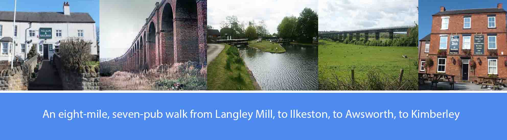
The overall route covers just over eight miles of easy walking, along mainly flat ground following parts of the Erewash and Nottingham canals. There are seven pubs featured en route, serving good cask ales; so, it’s a comfortable four-pint walk, allowing you to arrive home calorie neutral and none the worse for wear. The pubs are: the Bunny Hop and the Great Northern at Langley Mill; the Dewdrop and the Gallows Inn on the outskirts of Ilkeston; the Gate Inn at Awsworth; and the Nelson and Railway and the Cricketers Rest at Kimberley. Several other good pubs are available at Kimberley.
As well as the good ale, there are also along the way a number of points of historical interest. These include: the Great Northern Basin and the Erewash and Nottingham canals, the Bennerley Viaduct and Bennerley Ironworks, the Great Northern Railway Derbyshire Extension, and the Giltbrook Viaduct or ‘Forty Bridges’. Some background information about these points of interest, and relevant images, are featured in the route description below.
The route description
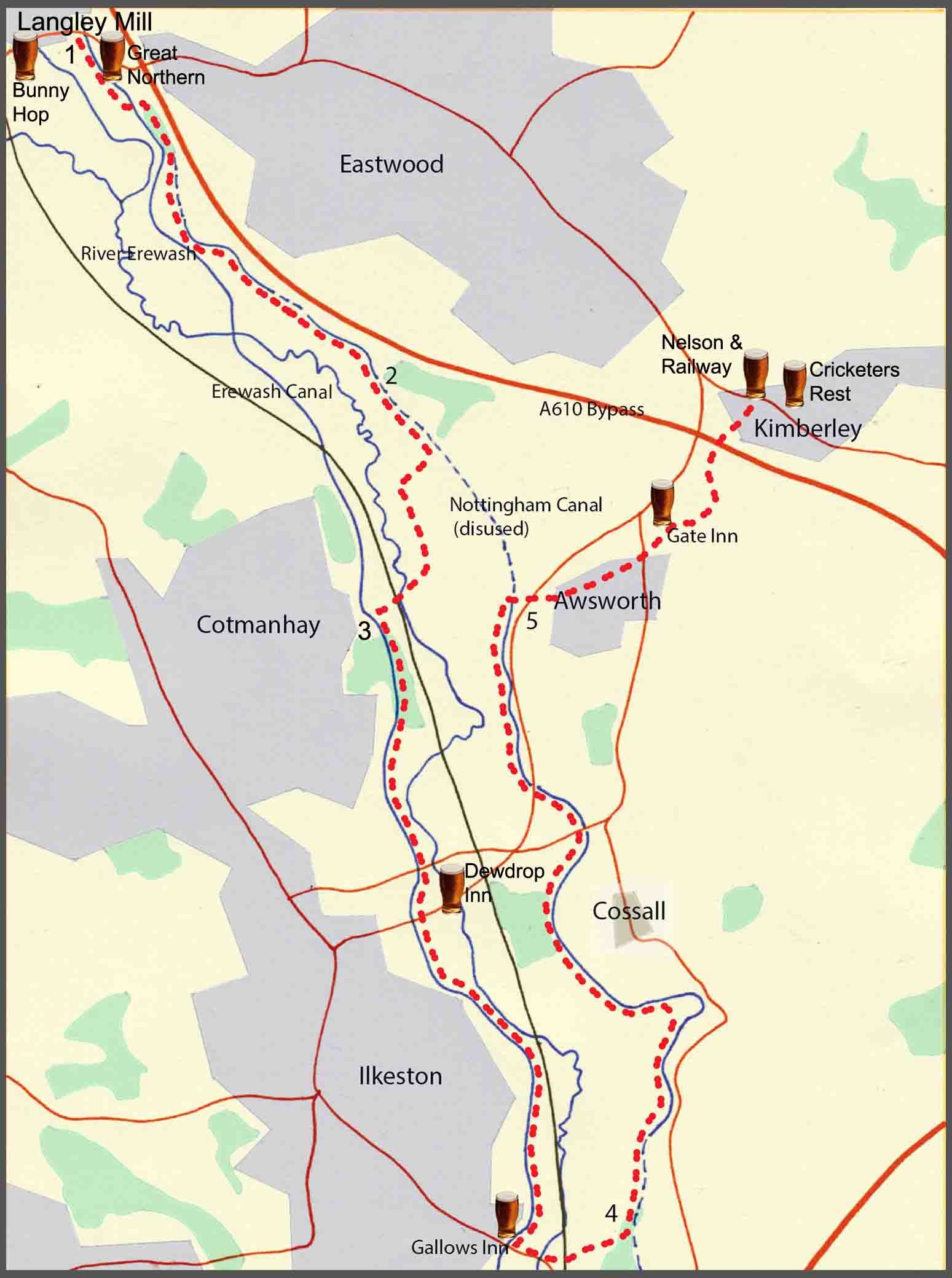
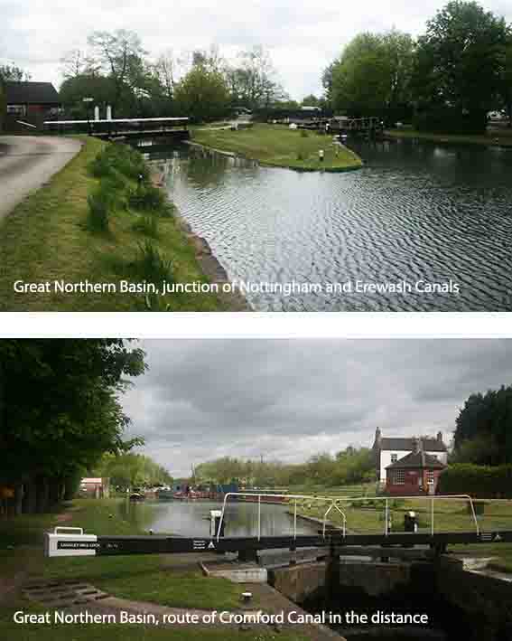
1. To the left of the Great Northern pub, you will find the Great Northern Basin and the Erewash Canal. Walk under the bridge that carries the main road over the canal and continue along the tow path for approximately a quarter of a mile until you come to the next canal bridge. Turn left to go over the bridge and, after a hundred yards, turn right onto a footpath that follows the route of the old Nottingham Canal. After walking along this footpath for a few hundred yards you will start to see, on your left, evidence of the old Nottingham Canal and, shortly after this, the footpath will meet a narrow roadway. Turn right here over an old canal bridge and then turn immediately left to continue along the old Nottingham Canal for just over a quarter of a mile where you will reach the junction with Newmanleys Road.
The Great Northern Basin once formed the junction of three waterways which were constructed between 1779 and 1796: the Cromford Canal, the Nottingham Canal, and the Erewash Canal. Later, in the 19th century, the basin was flanked by two great railways: the Midland Railway and the Great Northern Railway. The wharfs and facilities of the basin, and the two railways, provided a major transport hub for the mills, coal mines and ironworks, that developed in and around Langley Mill with the industrial revolution. Although commercial traffic stopped in the early 1950s, the basin and the Erewash Canal remain open today thanks to the work of the Erewash Canal Preservation and Development Association which was set up in 1968. The Erewash Canal runs for approximately eleven miles to Trent Lock where it joins the River Trent. However, much of the nearby Nottingham Canal has been filled in though some sections remain as a haven for a variety of wild life.
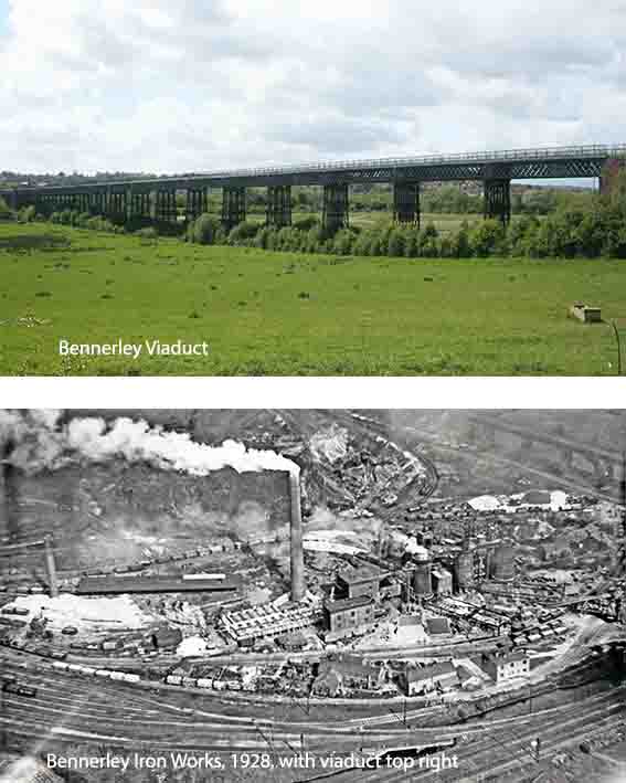
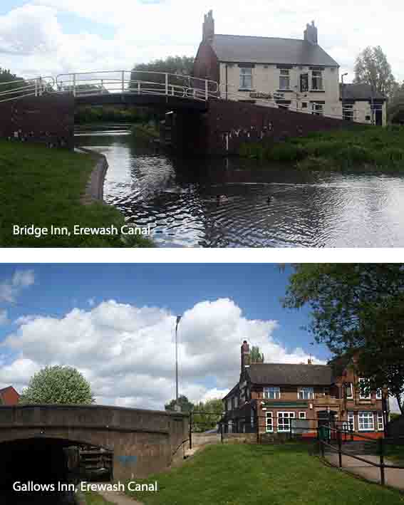
2. Cross over Newmanleys Road and take the footpath that follows the general direction of another filled-in section of the old Nottingham Canal. (Directly in front of you, in the distance, you will see ‘Winston’, Severn Trent’s wind turbine at the Newthorpe sewage works.) After about half mile you will reach a T-junction at the bridle way where you will turn right. Continue on for a further quarter of a mile and follow the sign to Cotmanhay along a path will take you over the River Erewash and under the main-line railway. A hundred yards past the railway you will see, on your left, the westerly end of the Bennerley viaduct in front of which was once situated the Bennerley Ironworks. Continuing on the path, you will soon arrive at the Erewash Canal and the canal bridge that gave its name to the pub, the Bridge Inn, now gone.
The Bennerley viaduct is 1452 feet long and over 60 feet high. It was completed in 1877 to take the Great Northern Railway Derbyshire Extension over the Erewash valley. Most railway viaducts at the time were brick-built, but it was felt that the lighter wrought iron lattice-work design was more appropriate to the underlying ground conditions. Restoration of the Viaduct is currently underway to incorporate it into a new cycle-path. Next to the viaduct, the Bennerley ironworks were opened in 1874 and three main blast furnaces operated until its closure in 1934. During the first world war, in 1916, a German Zeppelin dropped seven high-explosive bombs just to the north of the viaduct causing damage to the Midland Railway line at Bennerley Junction, which served the ironworks.
3. From the canal bridge at the former Bridge Inn, with the canal on your right, continue down the towpath for just over a mile until you reach the bridge with Sation Road, Ilkeston, overhead. Leave the canal here to walk a few hundred yards along Station Road to reach the Dewdrop Inn. From the Dewdrop Inn, return to the canal towpath and continue in the same direction as before for a further one and a quarter miles to reach the Gallows Inn at the southern end of Ilkeston. From the Gallows Inn, turn left and walk along the A609 main road, in the direction of Trowell, for approximately 200 yards. Cross over Furnace Road and, having just crossed over the River Erewash, turn left onto the path which leads to a footbridge over the railway line. Over the footbridge, carry straight on for a further 200 yards up a steep bank, and at the top of this turn left onto another filled-in section of the old Nottingham Canal. The walk now follows the route of the Nottingham Canal, northwards, back in the general direction of Eastwood and Langley Mill.
The Gallows Inn takes its name from the gallows which once stood nearby. In the 14th century, the plague threatened to interfere with the judicial system in Nottingham. As a result, the assizes were moved to Ilkeston and gallows were erected for the execution of convicted criminals. The gallows eventually fell into disrepair but remained standing until 1870 when they were blown down in a storm. The first inn on this site, The Crown, was built in 1765 but by 1798 it had become known locally as the Gallows Inn. The present building was built in 1936 by Joseph Shipstone and Son.
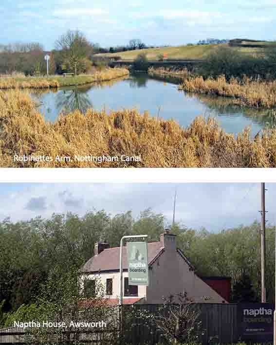
Prior to the opening of the Nottingham Canal, the transport of goods from the Erewash area, into Nottingham, was by the circuitous route along the Erewash canal to Trent Lock and up the River Trent. Also, without a more direct canal route into Nottingham, the Erewash Canal, and then the Cromford Canal, were exploiting Erewash Valley coal at the expense of Nottingham coal. This provided the impetus for Nottingham businessmen and coal owners to implement the building of the Nottingham Canal which became fully operational in 1796. The canal was designed by William Jessop and, in order to limit the need for locks along the Erewash valley, wherever possible the route ‘hugged’ the contours of the valley. Naphtha House, now a cattery and kennels, is all that remains of a major chemical industry in the area which produced the oil-based product, Naphtha, used in the petro-chemical industry.
The Giltbrook viaduct, known locally as ‘Forty Bridges’, was completed in 1875 and formed part of the Great Northern Railway Derbyshire Extension. Up to this time, the rail transport of coal from the surrounding Derbyshire and Nottinghamshire pits had been controlled by the Midland Railway and the Derbyshire extension to the Great Northern Railway was built to try and counter this monopoly. The viaduct was built using red bricks to create 43 arched spans with a total length of 1,716 feet (523 m) and a height of 60 feet (18 m). The viaduct was S-shaped and built in four sections. Houses were built into two of the arches and it is said that they were used as makeshift air raid shelters by school children from Awsworth during a First World War Zeppelin Airship bombing raid which dropped bombs at Bennerley Junction. The viaduct was demolished in 1973 to make way for the A610 bypass.
