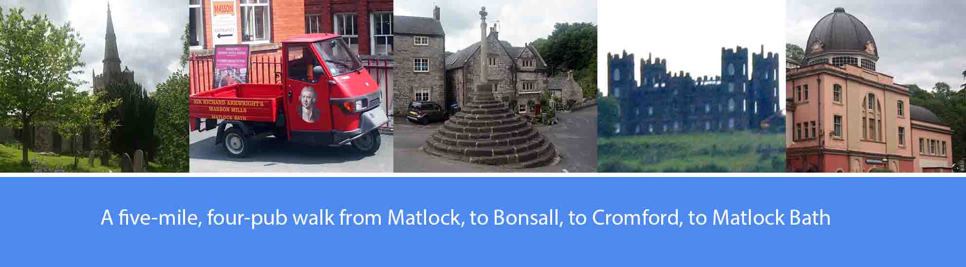
The route description
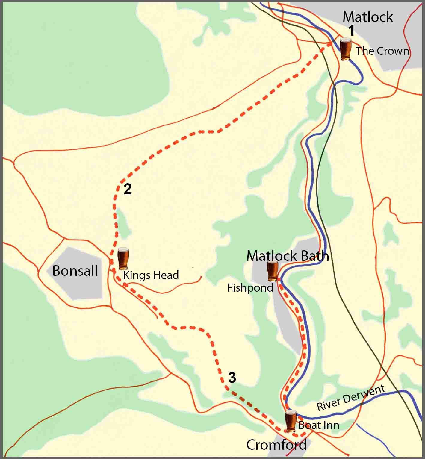
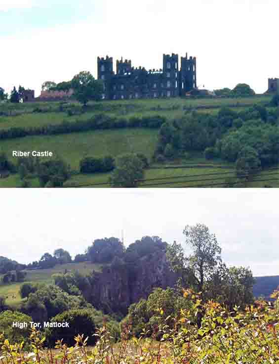
1. In the centre of Matlock, walk over Matlock Bridge in the Derby direction, and cross the A6 to Snitterton Street with the Royal Bank of Scotland on your right. Walk approximately a hundred yards up Snitterton Street and take the road to your left marked with a footpath sign. Walk along the road for approximately a hundred yards and at the farm buildings take the footpath ahead of you. Walk across the field and where the footpath forks left and right, bear right to the edge of the field, crossing a driveway, to re-join the footpath through a narrow wooded area. Continue on the footpath up a steep hill along a section of the Limestone Way with magnificent views below of Matlock, the northern end of High Tor, and Riber Castle . Approximately half a mile up the hill, cross over the farm track near Masson Farm, and continue straight ahead on the footpath continuing uphill until you meet another farm track. Bear right onto the track and, approximately fifty yards along, take the footpath on your left.
Matlock developed rapidly in the first half of the nineteenth century, largely as a tourist destination for those wishing to bathe in the thermal springs in the many ‘hydros’ being built in the town at that time. The largest of these, built in 1853 by the local industrialist and business man John Smedley, is now the headquarters of Derbyshire County Council. John Smedley also built Riber Castle as his family home; the ostentatious shell of the original castle, now converted into a series of luxury apartments, still overlooks Matlock from the top of the hill to the east. Smedley’s father, also called John Smedley, in 1794 co-founded with Peter Nightingale, Lea Mills which still operates to this day. The castle and the town of Matlock are key locations in the Shane Meadows film Dead Man’s Shoes. The limestone crag, High Tor, which dominates Matlock Dale beneath it, is reputed to be the last place in England where eagles nested.
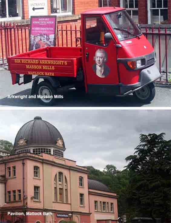
3. Take the path that turns to the right, off from the main track, opposite the marker post. Continue around the old quarry until the new path bears left and takes you steeply downhill. Continue downhill for approximately half a mile, through a thickly-wooded section, to reach Chapel Hill that soon joins the A5012, Via Gellia road, into Cromford. Walk along the main road for approximately a hundred yards and bear left into Scarthin, past Scarthin Books and the mill pond, to the Boat Inn on the right. From the Boat Inn, continue to the bottom of Scarthin and bear left at the main road to the junction with the A6. Cross over the junction and bear left, walking along the A6 with the River Derwent on your right and Willersley Castle on the hill beyond. After approximately a quarter of a mile along the A6, you will pass Arkwright’s Masson Mill on the right. Continue along the main road for a further half a mile with the old Matlock Bath Pavilion on the right and, on the opposite side of the road, the Fishpond pub.
Cromford has been referred to as the cradle of the industrial revolution, and one of its residents, Sir Richard Arkwright, is often called the father of the industrial revolution. In 1771, Arkwright built the world’s first successful water powered cotton spinning mill in Cromford which soon became so successful that he replicated his factory system elsewhere, building many other mills including Masson Mill in Matlock Bath. Others copied his ideas and water powered cotton spinning mills began to spring up in Europe and America. Arkwright was attracted to Cromford because of the plentiful supply of water to power the mills and a ready supply of cheap labour with the decline of local lead mining. As production increased, Arkwright brought in workers from other areas and, to accommodate them, he and his son were responsible for most of the buildings and much of the layout of present-day Cromford. In 1776, Arkwright built the three-storey dwellings in North Street; in 1778, he built the Greyhound Hotel; just before he died in 1792, he began building Willesley Castle; in 1832, his son Richard built the school at North Street to comply with new legislation requiring children to spend only part of the day at work and the other part in school.
About this walk
The walk described below starts from the centre of Matlock, up over the hills to Bonsall, down to Cromford and then finishes in Matlock Bath. However, the start and finish points are interchangeable, with both sited on the A6 and the route of the Trent Barton Transpeak bus connecting Buxton and Derby, and other buses to Alfreton and to Ripley.
The overall route covers just five miles, much of it along the Limestone Way, and with some fairly steep hill sections. There are four pubs featured en-route, serving good cask ales, fairly evenly spaced; so, at five miles, it’s a comfortable two-pint walk, allowing you to arrive home calorie neutral and none the worse for wear. The pubs are: J D Wetherspoon’s the Crown at Matlock; the King’s Head at Bonsall; the Boat Inn at Cromford; and the Fishpond at Matlock Bath. Several other good pubs are available in Matlock and Matlock Bath.
As well as the good ale, there are also along the way a number of points of historical interest. These include: the role played by the thermal springs in the development of Matlock as a Victorian tourist destination; the importance of lead mining in the area going back to Roman times; the frame-knitting cottage industry in Bonsall; and the importance of Cromford at the start of the industrial revolution and in the development of the modern factory system.
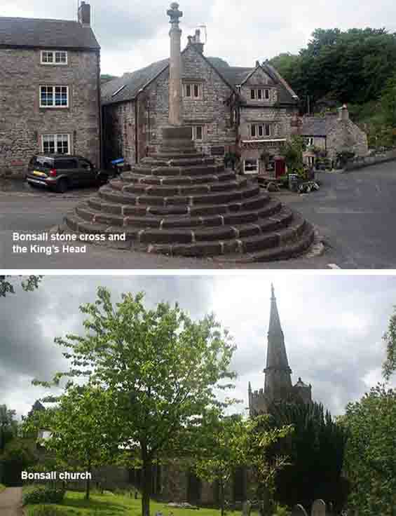
2. Continue uphill for approximately two hundred yards where the footpath will begin to level off. In another couple of hundred yards cross over the farm track and continue over the field for just over half a mile to join a well-established part of the Limestone Way leading downhill through a thickly-wooded area. After approximately a quarter of a mile downhill, the path levels off for a couple of hundred yards before continuing down a very steep section which leads directly into Bonsall at the village stone cross just in front of the King’s Head which dates back to 1677. The route continues from the King’s Head, bearing right along Church Street, past the Church on your right. Walk to the end of Church Street and follow the farm track in front of you until it bears left to follow the fenced perimeter of the disused quarry. Follow the track around almost the whole of the perimeter of the quarry until you reach a marker post, directly opposite of which there is another path that turns off to the right, away from the main track.
Bonsall has a long history of lead mining, possibly dating back to Roman times, and the moors above are pock-marked with the remains of lead mines. When lead mining began to decline in the late eighteenth century, many inhabitants found work in textile manufacture, first in their own homes using small frame-knitting machines, and later in the mills established by Arkwright at nearby Cromford and Via Gellia. This transition from the ‘cottage industry’ of frame-knitting in the workers’ own homes, to the mass employment of the factory system pioneered by Arkwright, was a key stage in the industrial revolution in the late eighteenth and early nineteenth centuries. Early in the industrial revolution there were well over a hundred frame knitters in Bonsall, mostly manufacturing hosiery, working in their homes. Beneath the eaves of a number of Bonsall cottages you can still see to this day, the characteristically long upstairs windows, originally designed to provide additional light to help the frame-knitters at their machines.