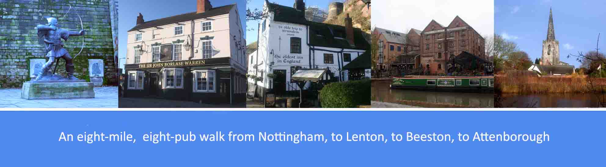
About this walk
The walk described below starts from Canning Circus, above Nottingham city centre, through to the Nottingham and Beeston Canal near Nottingham’s railway station, and then along the canal to the suburb of Lenton, to Beeston Rylands and finishing in the village of Attenborough. However, the start and finish points are interchangeable, and can be reached by regular buses from Nottingham city centre.
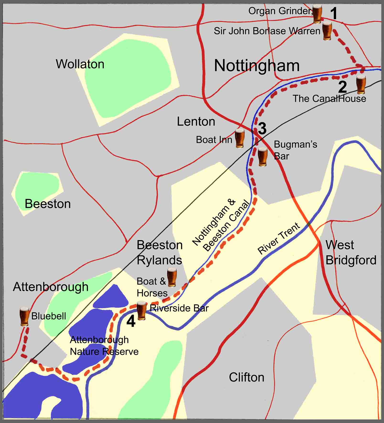
The overall route covers just under eight miles, some through Nottingham’s historic city centre, and most of it off-road along the canal towpath, and through the nature reserve at Attenborough. There are eight pubs featured en-route, serving good cask ales; so, at just under eight miles, it’s a comfortable three or four-pint walk, allowing you to arrive home calorie neutral and none the worse for wear. The pubs are: at Canning Circus, the Organ Grinder and the Sir John Borlase Warren; near the castle, Ye Olde Trip to Jerusalem; near the railway station, the Canalhouse; at Lenton, Bugman’s Bar, the Boat Inn; at Beeston Rylands, the Boat & Horses; and at Attenborough, the Bluebell. Several other good pubs are available at Nottingham.
As well as the good ale, there are also along the way a number of points of local and historical interest. These include: Canning Circus; Standard Hill and its connection with the English Civil War; the Nottingham Castle and Ye Olde Trip to Jerusalem; the Nottingham & Beeston Canal; the Games Workshop PLC; and the Attenborough Nature Reserve.
The route description
1. From the side of the Sir John Borlace Warren in Canning Circus, cross Derby Road and turn left into the Ropewalk. Walk to the bottom of the Ropewalk, a distance of just under a third of a mile, then turn left into Park Row and then right into Postern Street. At the bottom of Postern Street, bear right into St James’s Terrace and continue straight down Standard Hill and then cross over to the right into the pedestrianised area. Follow the pedestrianised area downhill, in front of the castle, and further into Castle Road where you will find Ye Old Tripe to Jerusalem on your right. At the bottom of Castle Road, turn left and cross over Castle Boulevard and then continue straight on into Canal Street where you will find the Canalhouse on your right. From the Canalhouse, continue along Canal Street and then turn right into Carrington Street. On Carrington Street, cross over the bridge with the canal below, and immediately turn right to walk down the steps to reach the canal towpath. With the canal on your right, continue along the towpath, passing the back of the Canalhouse pub and several converted wharf buildings.
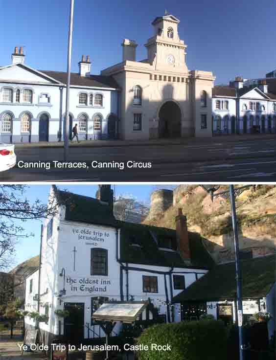
Bordering Canning Circus is Canning Terrace which was built as a series of almshouses for the poor, and was named after George Canning who became Prime Minister in 1827, albeit only for four months. Standard Hill, at the bottom of the Ropewalk, is so named because it was there, in 1642, that King Charles I raised his Royal Standard, in effect declaring war upon the Parliamentarians and marking the beginning of the English Civil War. Ye Olde Trip to Jerusalem claims to have been established in 1189, which would make it the oldest pub in England, though there is no documentation to verify this date. The medieval Nottingham Castle, built in 1067, which once stood on the natural promontory known as ‘Castle Rock’, was a major royal fortress and occasional royal residence. In decline by the 16th century, it was largely demolished in 1649 to be replaced by a mansion built by Lord Newcastle and later burnt down by rioters. The ruin was eventually rebuilt to house an art gallery and museum, which remain in use to this day.
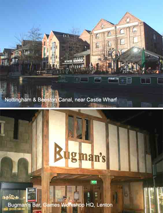
2. Walking past the converted canal wharf buildings, the towpath will take you under a road bridge with the Navigation pub off to the right and, just over half a mile further along, you will reach Castle Marina and the Waters Edge pub on your left. A few hundred yards further on, passing under the railway bridge, you will reach another bridge that takes Lenton Lane, and the tram line, over the canal. By leaving the canal at Lenton Lane you can easily reach Bugman’s Bar, the Boat House and the Johnson Arms. To reach Bugman’s bar, turn right along Lenton Lane and after two hundred yards bear right again into Willow Road with the Games Workshop PLC headquarters, including Bugman’s Bar, over to your left. For the Boat House, turn left at Lenton Lane to cross over the canal and after two hundred yards bear left again into Old Church Street at the bottom of which you will bear right onto Priory Street to reach the Boat House. The Johnson Arms is on Abbey Street, just over a hundred yards further on from the Boat House.
The section of the canal between Trent Bridge and Lenton, now referred to as the Nottingham & Beeston Canal, is the only navigable part remaining of the Nottingham Canal which once ran for 14.7 miles from Langley Mill in Derbyshire. Opened in 1796, the Nottingham Canal was built to bring coal from nearby collieries into Nottingham, but competition from the later development of the railways contributed to the decline and eventual abandonment of much of the canal. Bugman’s Bar, situated within the Games Workshop PLC world headquarters in Lenton, is named after the fictional Josef Bugman, the greatest dwarf brew-master from the Warhammer fantasy game. The Games Workshop Group manufactures and distributes wargames, based upon collecting, modelling, painting and tabletop gaming with model soldiers. Its best-known products are Warhammer Age of Sigmar and Warhammer 40,000. The Lenton-based company also has wholly-owned subsidiaries in the US, Canada, France, Germany, Spain, Australia, Japan and Italy.
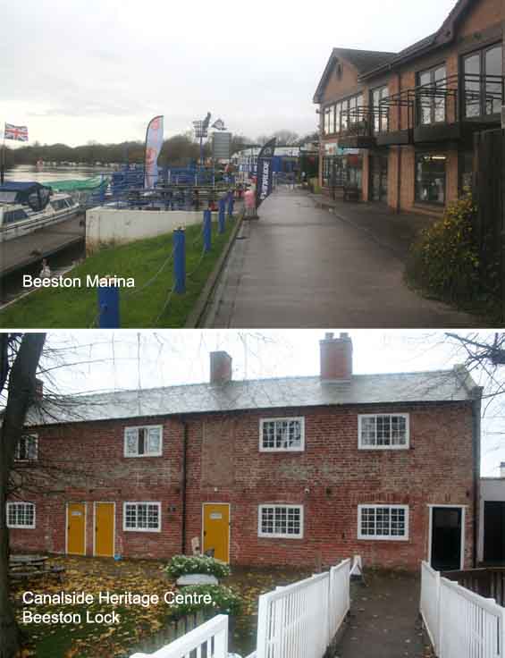
3. To resume the walk, return to Lenton Lane and continue along the towpath with the canal on your right. Walk along the towpath for just over two and a quarter miles until you reach a bridge that crosses the canal and leads into Beeston Rylands. At this point you will see the River Trent, over to your left, running parallel to the canal. Cross over the bridge and immediately bear left into Canal Side. Walk just over a quarter of a mile down Canal Side and then turn right into Trent Road where you will find the Boat and Horses just under two hundred yards further along Trent Road on your right. To resume the walk, continue along Canal Side to reach Beeston Lock where the canal meets the River Trent. The route now follows the river and three hundred yards further on from Beeston Lock is the Beeston Marina and the Waterside Bar.
From Lenton, the Nottingham Canal would have continued westwards to Wollaton and Trowell and then northwards to Langley Mill. At Lenton, the Nottingham Canal was joined by the Beeston Cut along which the route of the walk now continues. Built by the separate Trent Navigation Company at the same time as the main line of the Nottingham Canal, the Beeston Cut connected the main canal line at Lenton in Nottingham to rejoin the River Trent upstream of Nottingham at Beeston, thereby bypassing the difficult section of navigation through Trent Bridge. The Canalside Heritage Centre at Beeston Lock was opened in 2017 with the aim of providing an asset to the local community and an educational facility on the river Trent. The Canalside Heritage Centre charity secured funding to renovate four cottages built in 1796 for canal workers. The building includes a shop and cafeteria, with a meeting room upstairs, and one cottage has been left intact as part of a display area. There is also an impressive balcony overlooking the river and weir.
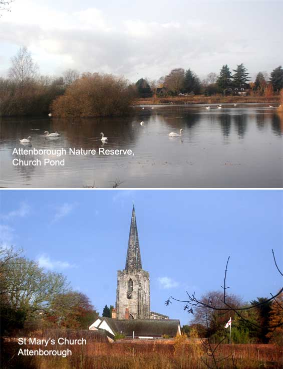
4. From Beeston Marina, continue along the path with the river on your left and the lagoons of Attenborough Nature Reserve over to your right. Ignore the two right turns off the path, signposted for Meadow Lane and, just under one and a quarter miles from the marina, there is a fork in the path. Take the right-hand fork and, after just under four hundred yards, cross the metal bridge over the lagoons. Over the bridge, continue on the footpath until you reach the cricket field to your right, and at this point bear left, off the main footpath, to walk around the edge of a lagoon. Continue around the lagoon, passing through a wooded area, until you reach a fork in the path signposted left for Attenborough Nature Centre and right for Attenborough village. Take the right-hand fork and walk towards St Mary’s Church. As you leave the church grounds, immediately on your left is Attenborough Drive. Turn left into the drive and, after a few yards, bear right onto a path that leads between the houses. Continue on the path, crossing the railway line, and when you reach Barratt Lane, bear left and then around the corner to the right and up to the main Nottingham Road. Turn right into Nottingham Road where you will find the Boat and Horse a hundred yards up on the right.
The Attenborough Nature Reserve covers 145 hectares of lakes, wetland, grassland and scrub and is managed by the Nottinghamshire Wild Life Trust. Its large lakes are formed from the flooding of gravel pits from which gravel was extracted between 1929 and 1967. The gravel extraction company, CEMEX, still owns the site although it has now agreed to sell the site to the Trust, subject to availability of funds. The Attenborough Nature Centre at the reserve provides an educational facility, shop and café, and car park accessed from Barton Lane, Attenborough. Sir David Attenborough, whose family takes its name from the village of Attenborough, opened the reserve in 1966 and then returned in 2005 to open the Nature Centre