About this walk
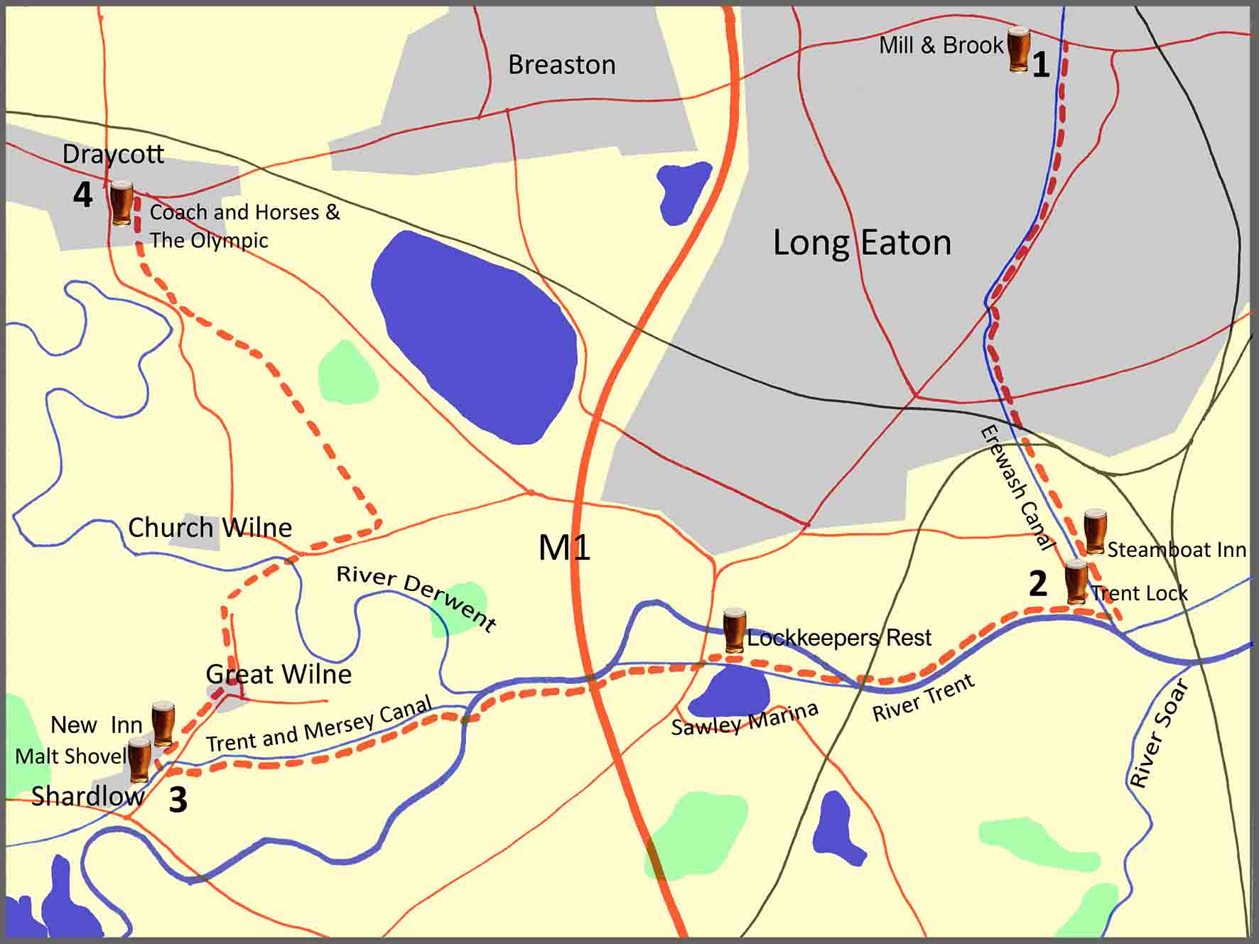
The walk described below starts from Long Eaton, going first along the Erewash Canal to Trent Lock, then on the River Trent and the Trent and Mersey Canal to Shardlow, before going to the village of Great Wilne and then finishing in Draycott. However, the start and finish points are interchangeable, with excellent bus services from various locations in the area including Derby and Nottingham.
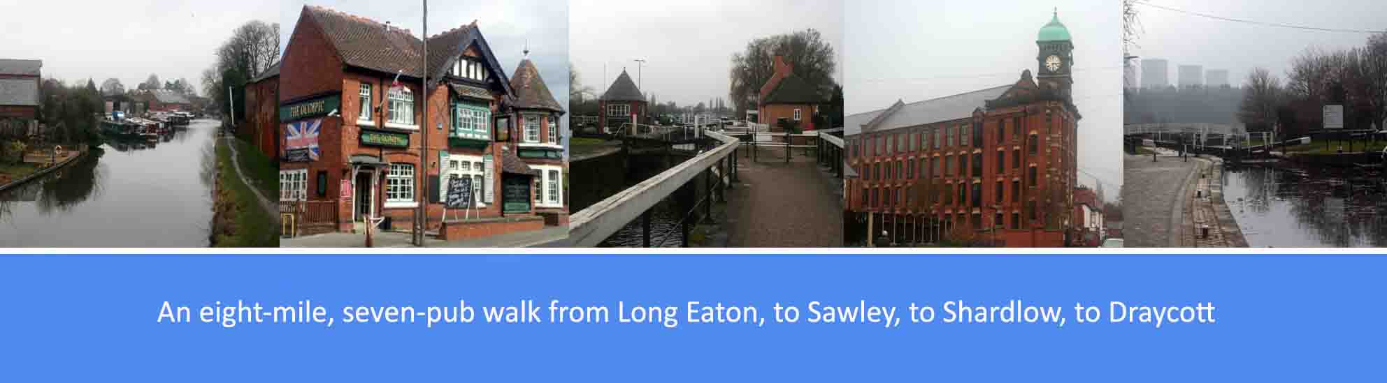
The overall route is just under eight miles, the majority of it on canal towpaths or riverside tracks. There are six pubs en-route, serving good cask ales; so, at nearly eight miles, it’s a comfortable three or four-pint walk, allowing you to arrive home calorie neutral and none the worse for wear. The pubs are: the Mill & Brook, Long Eaton; the Trent Lock and the Steamboat Inn, at Trent Lock; the New Inn and the Malt Shovel, at Shardlow; and the Coach and Horses and the Olympic, at Draycott. Several other good pubs are available at Long Eaton and Draycott.
As well as the good ales, there are also along the way a number of points of historical interest. These include: Trent Lock and its role in the development of canal navigation; Shardlow and its role as an important late eighteenth century inland river port; evidence of a deserted medieval settlement at Church Wilne; and the role of Draycott in the history of cotton and lace manufacturing.
Route Description
1. From the Mill & Brook, just outside the centre of Long Eaton, on Derby Road, join the towpath of the Erewash canal and walk in a southerly direction making sure the canal in on your right. After approximately three quarters of a mile, the towpath passes under the B6540, the main Tamworth Road, and continues on to take you out of Long Eaton into open countryside. After a further one and a quarter miles on the towpath, you will arrive at Trent Lock, an important junction in the British waterways system formed from the confluence of the River Trent, River Soar and the Erewash Canal. Here you will find the Steamboat Inn, the Lock House Tearooms and the Trent Lock pub.
Trent Lock, and the surrounding area, represent a series of major canal and river navigation junctions which, from the late 18th century to the early 20th century, played a vital role in the transportation of goods through the midlands and parts of the north. Trentlock itself is at the point where the counties of Derbyshire, Leicestershire and Nottinghamshire meet, and where the River Soar and Erewash Canal flow into the River Trent. The short Cranfleet Cut provides a route for boats heading downstream on the Trent towards Nottingham, avoiding a weir. Some way further to the west on the Trent is the Sawley Cut and Sawley Bridge Marina, and not far west of that is Derwent Mouth, where the River Derwent and the Trent and Mersey Canal join the Trent. Immediately to the north-east of Trent Lock is Trent Junction, a similarly important five-way meeting point in the national railway system.
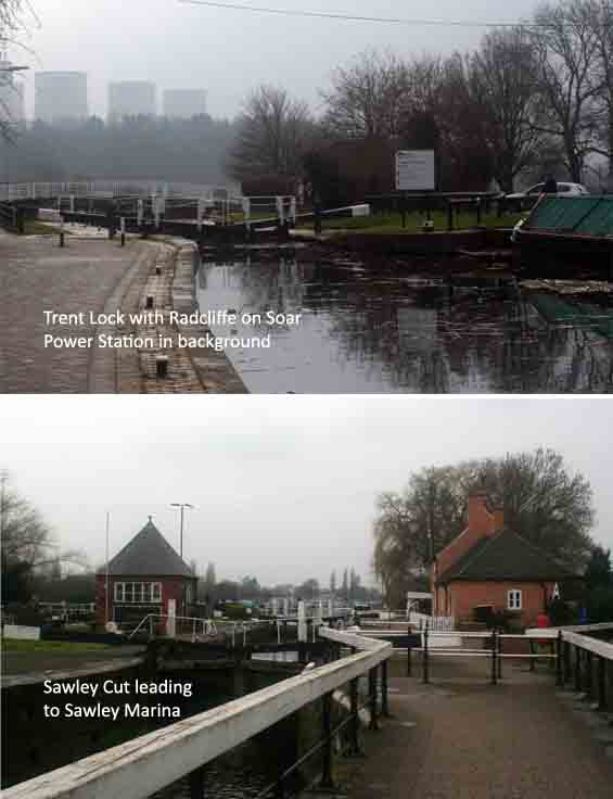
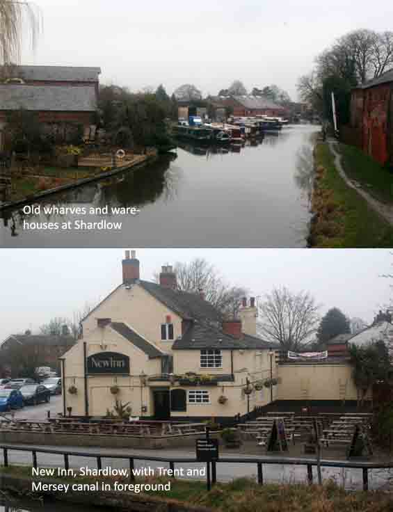
2. From Trent Lock, join the path along the River Trent and walk in a westerly direction making sure the river is on your left. Continue along the river for three quarters of a mile where you will cross a bridge over the river and join the towpath of the canal, at Sawley Lock, that connects Sawley Marina to the River Trent. Continue on the towpath for just under half a mile, with Sawley Marina and the canal on your left, and cross over the main Tamworth Road to rejoin the towpath with the canal now on your right. Four hundred yards further on you will re-join the river and pass under the M1. Half a mile after the M1, where the river turns to the left and the River Derwent joins the Trent, cross over Long Horse Bridge and bear right to join the Trent and Mersey Canal. Walk along the towpath for just over three quarters of a mile and, leaving the canal, join Wilne Lane where you will bear right to cross over the canal with the Malt Shovel and New Inn at Shardlow within sight.
From 1760 onwards the development of the Trent and Mersey canal close to the river made Shardlow the ideal place for a canal port for the storage and transport of a range of goods, from raw materials like coal and iron, to cheeses and other produce. The population of three hundred soon grew to over a thousand and by 1816 a dozen warehouses had been built as well as other buildings that included offices, breweries and inns, boat builders and workshops for the vessels, and adequate housing for the owners, workers and their horses. For approximately seventy years the area continued to expand and thrive but, with the rise of the railways, it went into decline and today the Shardlow canal port is no longer a working wharf, though many of the buildings and warehouses have been preserved and restored as places of historical importance.
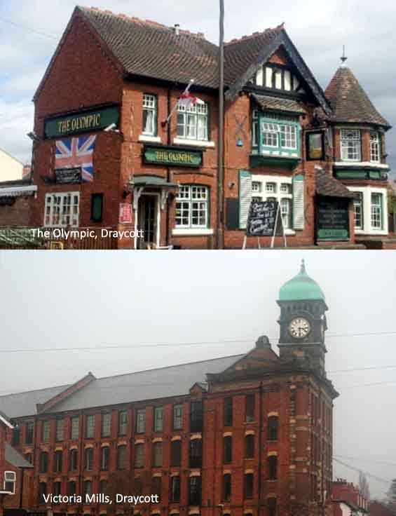
3. From the Malt Shovel and New Inn, bear left onto Wilne Lane and walk for a quarter of a mile into the village of Great Wilne. Continue on for a further quarter of a mile to the end of Wilne Lane and then, beyond the gate, bear right to join the Midshires Way. A quarter of a mile further on across the field, take the bridge over the River Derwent and bear right onto Wilne Road. After a third of a mile along Wilne Road, bear left to continue on a track along the Midshires Way. (Immediately to the right of the Midshires Way, there is an alternative parallel route that follows slightly higher ground along a flood defence bank.) Just under a mile along the track, bear right to re-join Wilne Road and then, after a hundred yards, bear right again onto the footpath. Walk a quarter of a mile along the footpath until you reach Lodge Street and the Coach and Horses in the centre of Draycott. The Olympic pub is a further two hundred and fifty yards to the right along Station Road and the main bus route to Nottingham and Derby.
The Romans built a road from Derby, to what is now Trent Lock, and along this route a small community established and was noted in the Doomsday Book as Dry Cote (a ‘dry place’). Nearby there was an earlier settlement at Church Wilne which St Chad used in the 7th century as his base to spread Christianity throughout what was then the Kingdom of Mercia. Although the village of Church Wilne has long since disappeared, evidence of a medieval settlement, near its church of St Chads, was identified in the late 1960s. Most of Church Wilne’s inhabitants migrated to Draycott, initially possibly because of flooding in the Derwent plain and later because of the opportunities of employment as the Industrial Revolution brought canals, railways and lace mills to Draycott. Although lace manufacture in Draycott no longer exists, some of the old mill buildings remain, notably the Victoria Mill which, at the time of its completion in 1907, was the largest lace manufacturing plant in Europe. The four-storey building with its green copper capped ornamental clock tower still dominates the skyline.