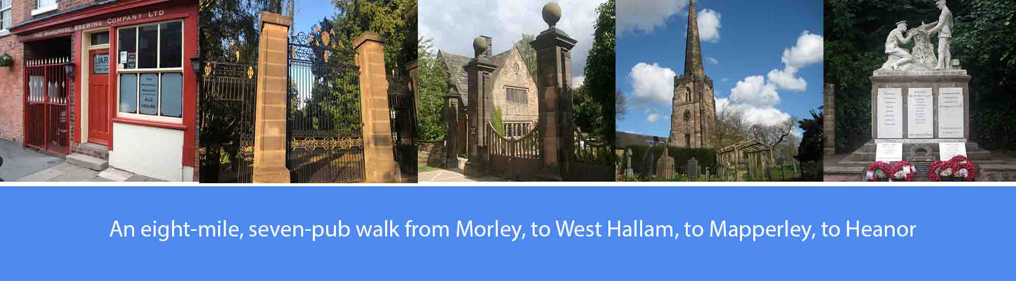
About this walk
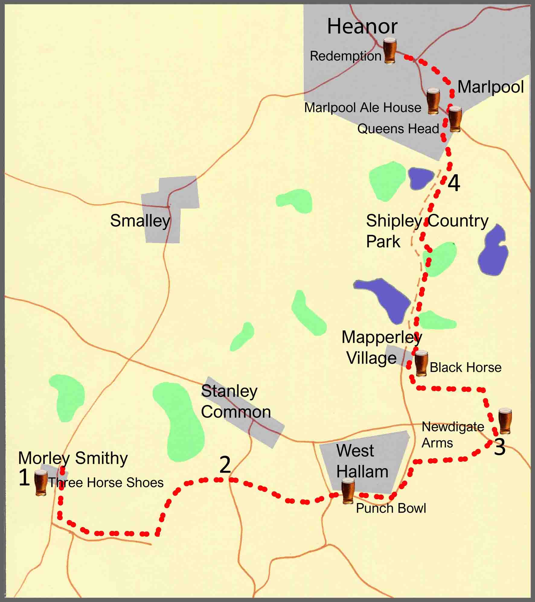
The walk described below starts at the Three Horse Shoes pub, Morley Smithey, continues into the villages of West Hallam and Mapperley, before finishing in Marlpool and Heanor. However, the start and finish points are interchangeable, and you can easily get to them by a variety of local buses. If you wish, you can also reduce the length of the walk by catching a bus at a number of intermediate points.
The overall route covers just over eight miles across undulating ground with some moderately steep hills. There are seven pubs featured en route, some fairly evenly spaced, serving good cask ales; so, at just over eight miles, it’s a comfortable four-pint walk, allowing you to arrive home calorie neutral and none the worse for wear. The pubs are: the Three Horse Shoes at Morley; the Punch Bowl and the Newdigate Arms at West Hallam; the Black Horse at Mapperley Village; the Queens Head and the Marlpool Alehouse at Marlpool; and the Redemption at Heanor. Several other good pubs are available at Heanor.
As well as the good ale, there are also along the way a number of points of historical interest. These include: St Matthew’s Church, Morley, and the Sacheverell-Bateman Mausoleum; the Derbyshire Portway; the impact of the 17th century Reverend John Scargill on the village of West Hallam; the Shipley Country Park and the Miller-Mundys; and the Marlpool Alehouse.
The route description
1. From the Three Horse Shoes pub, Morley Smithey, walk a quarter of a mile along the A608 in the direction of Derby and then turn left into Church Lane, bearing left again by the side of St Matthew’s Church, Morley. From the church, continue down Church Lane for just under three quarters of a mile and then take the footpath through the field off to the left. At the bottom of the field, take the stile and cross over the footbridge, over the ditch, into the next field. Cross over the field and, bearing slightly right, follow the footpath through more fields downhill towards Park Farm. Keeping to the right of Park Farm, follow the footpath over a stile to enter the farm track. Just over a hundred yards further on, leave the track and take the footpath off to the right through two fields. At the bottom of the two fields, follow the footpath through a copse and then walk steeply uphill until you reach Common Lane which connects Stanley Common with Stanley Village.
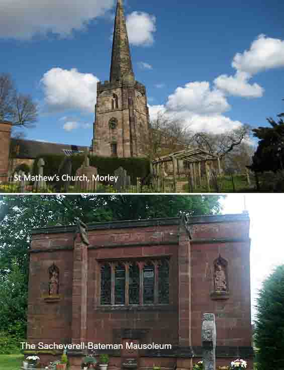
St Matthew’s Church, Morley is a Grade I listed building and features in Simon Jenkins’ book ‘England’s Thousand Best Churches’. The oldest part of the church dates back to the 13th century and is noted for its ancient stained glass windows which were removed from Dale Abbey at the Dissolution of the Monasteries in the 16th century. The Sacheverell-Bateman Mausoleum is a Grade II listed structure and was erected in 1897 in the grounds of St Matthews Church, Morley. It was commissioned by Mrs Anna Bateman, wife of the late Sir Hugh Alleyne Sacheverell-Bateman who died in a riding accident in Morley Hayes wood in 1896. Sir Hugh was Lord of the Manor of Morley but never lived in the original manor, which had been demolished many years earlier. Church Lane follows part of the route of the Derbyshire Portway which is an ancient trackway, at least 3,000 years old, connecting the Bronze Age fort at Mam Tor to the North Sea via Nottingham.
2. Cross straight over Common Lane and, at the bottom of the track that leads to Briggswood farm, take the stile and footpath off to the right. Follow the footpath, passing Briggswood Farm on your left, until you reach a farm track. Bear left onto the track and, after fifty yards, take the right turn along the track until you come to a footpath off to the left. Follow the footpath and, just where it passes under the electricity pylons, bear right across the field. Having crossed the field, bear right again along a rough track with a hedgerow to your left. Continue to the bottom of the rough track until you reach Station Road on the outskirts of West Hallam. Cross over Station Road and, bearing right, walk along Beech Lane for just under half a mile until you reach the Punch Bowl at West Hallam. From the Punch Bowl, bear left past the war memorial, and walk down St Wilfred’s Road. Walking past the Scargill Road turning on your left, continue along St Wilfred’s Road for a further hundred yards and take the footpath off to the right. Continue along the footpath until you reach a track which you will follow straight ahead to reach High Lane East, the main road between West Hallam and Ilkeston. Cross over High Lane East to reach the Newdigate Arms a few yards up the road.
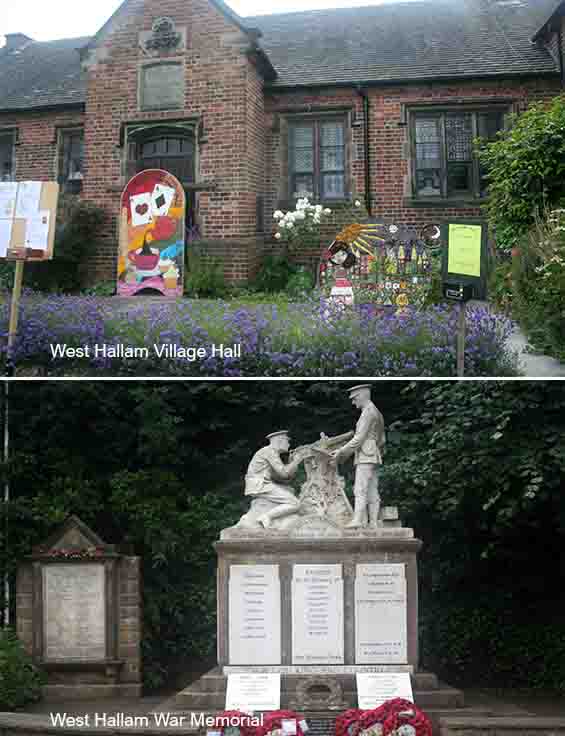
West Hallam Village Hall is a Grade II listed structure and was originally built as an infant school in 1852, funded by a legacy of the Reverend John Scargill. Scargill was Rector of St Wilfred’s Church, West Hallam, from 1638 until his death in1662. In his will, Scargill made provision for a school for boys from West Hallam, Mapperley, Dale Abbey and Stanley/Stanley Common. The first school was opened in 1664 and since then there has always been a Scargill School in West Hallam. The War Memorial, outside St Wilfrid’s Church, was first dedicated in 1921 and is now a Grade II listed structure. It consists of a sculpture of two soldiers with a Vickers Machine Gun in Italian marble, standing on a Derbyshire Gritstone plinth. The memorial originally recorded the names of the nine parishioners who lost their lives in the 1914-18 war and, unusually, a further sixty-three that served. Subsequently, the dedication was extended to include the names of those who died in the 1939-45 war.
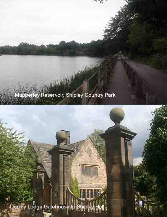
3. From the Newdigate Arms, bear right and, a hundred yards along the main road, turn right down the lane that runs past the pub car park. Four hundred yards down the lane, take the track off to the left that leads through a wooded area and scrub land. Half a mile along the track you will reach the main road into Mapperley Village. Turn right and walk along the road for just under half a mile, past Holy Trinity Church on your right, and then turn left at the cross roads to reach the Black Horse Inn at Mapperley. From the Black Horse, bear left and then left again at the cross roads and walk down the lane into Shipley Country Park. Passing Mapperley Reservoir on your left, walk along the lane, past the car park, and at the top of the hill you will pass the Victorian Farm which once provided food for Shipley Hall, the foundations of which can still be seen in the woodland beyond the farm. Continue downhill, past the café at Derby Lodge which was once one of Shipley Hall’s two gate houses. Further along, down the lane, you will reach Osbourne’s Pond on your left.
Shipley Country Park was opened by Derbyshire |County Council in 1976, formed from land reclaimed from local collieries and opencast mining operations. The Shipley estate had been an ancient manor, mentioned in the Domesday Book, and from the 14th century the land was covered in extensive forest used for hunting. Shipley Hall was built in 1700 and, by 1722, coal mining was an important activity on the Shipley estate. The Hall became the property of the Miller-Mundy family, and in the late 19th century, under Alfred Edward Miller Mundy, the colliery became increasingly prosperous which enabled further developments to take place to the estate, including the building of a model dairy and farm, and the water tower to feed it, a doubling of the size of the hall and the creation of a cricket ground. After the collieries were nationalised in 1948, it was decided that the Hall was too damaged by subsidence to be worth keeping, and so it was demolished. The Woodside and Coppice collieries were regarded as uneconomical and were closed in the 1960s, ending over 250 years of deep mining at Shipley. There was a legacy of spoil heaps, derelict buildings, polluted lakes and thirty abandoned mine shafts, all of which had to be dealt with before the park was finally able to open to the public in 1976.
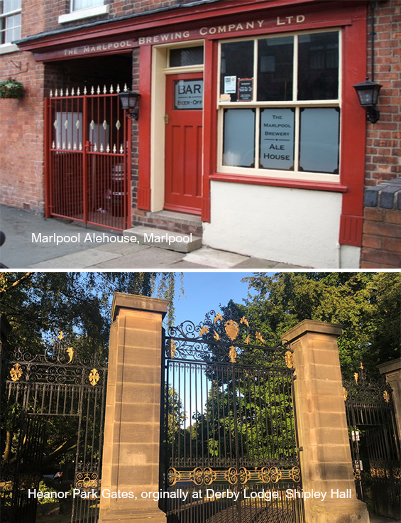
4. Just past Osbourne’s Pond, bear left, under the old railway bridge to exit the country park at Roper Avenue. Bear left into Roper Avenue and then bear sharp right into Buxton Avenue. Walk just over a quarter of a mile to the top of Buxton Avenue and, at the junction, turn right and walk four hundred yards uphill along Sunningdale Avenue until you reach the crossroads where you will see the Queens Heads across the road, over to the left. The Marlpool Ale House is on Breach Road next door to the Queens Head. From the Marlpool Alehouse, turn left and walk less than a hundred yards along Breach Road to turn left into Mill Lane. A hundred yards along Mill Lane, turn left into Mill Bank. At the end of Mill Bank, follow the alley way until you reach Ella bank Road. Cross over the road and continue straight ahead along the alley way, walking past Heanor Memorial Park on you left. At the main road, cross over and walk up Mundy Street and turn right into Wilmot Street to reach Heanor Market Place and the Angry Bee micropub. The Redemption micropub is on Ray Street, a few yards past the Market Place.
The ornamental iron gates at the entrance to Heanor Memorial Park were originally the gates from Shipley Hall’s Derby Lodge gatehouse. According to a study published in 2006, Heanor, including Marlpool, is the second most quintessentially English place in the country, with the most English town being Ripley, just three miles away, with 88.6 per cent of those living there being of English origin. The Marlpool Alehouse and Brewery, said to be Derbyshire’s first micropub, was set up by brothers Andy and Chris McAuley in 2010 in a former butcher’s shop and slaughter house. The bar is a pulpit reclaimed from an old local Methodist Chapel. The alehouse contains a range of brewing memorabilia, including many unopened bottles of vintage beers.