About this walk
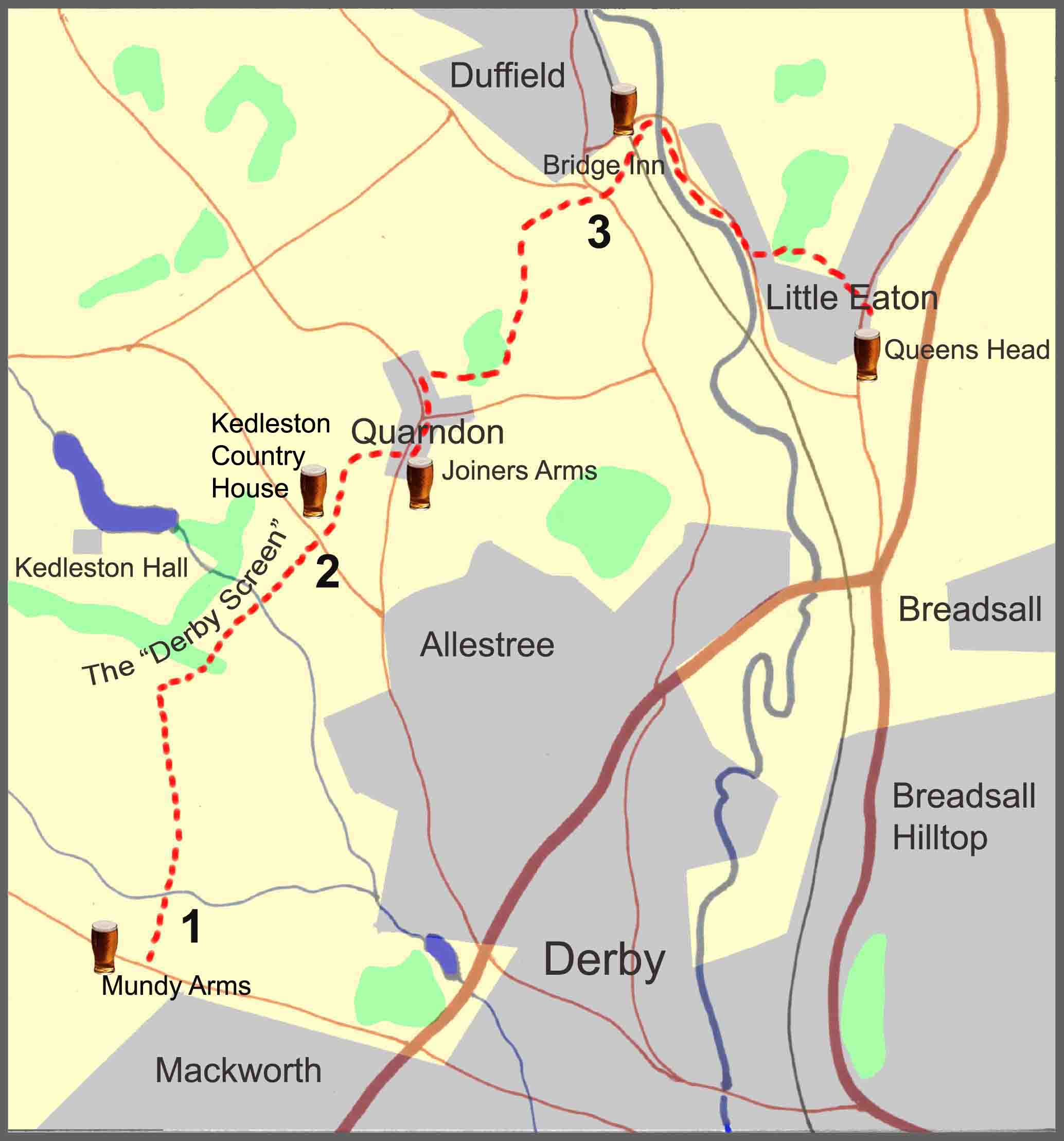
The walk described below starts from just outside the village of Mackworth, on the outskirts of Derby, on the main Derby to Ashbourne bus route. The walk continues through the villages of Quarndon and Duffield before finishing in Little Eaton. However, the start and finish points are interchangeable, with good bus services from both Derby and Nottingham.
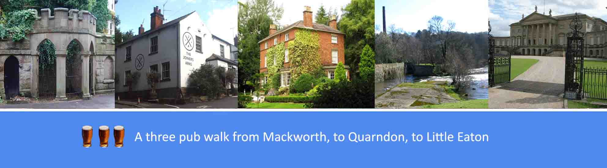
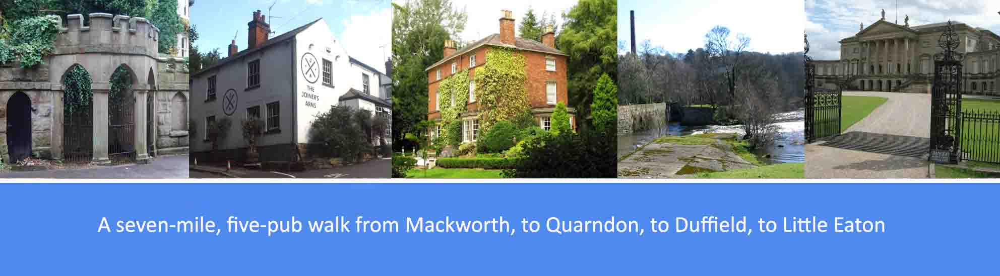
The overall route covers seven miles following undulating footpaths and some short distances by road. There are five pubs featured en route, fairly evenly spaced, serving good cask ales; so, at seven miles, it’s a comfortable three-pint walk, allowing you to arrive home calorie neutral and none the worse for wear. The pubs are: The Mundy Arms at Mackworth, the Kedleston Country House outside Quarndon; the Joiners Arms at Quarndon, the Bridge Inn at Duffield; and the Queens Head at Little Eaton.
As well as the good ales, there are also along the way a number of points of historical interest. These include: The Bonnie Prince Charles Way, celebrating Charles Edward Stuart’s march from Ashbourne to Derby in 1745; Kedleston Hall and the “Derby Screen”; the “Chalybeate Wellhouse” at Quarndon; and the Peckwash Paper Mill between Duffield and Little Eaton.
Route Description
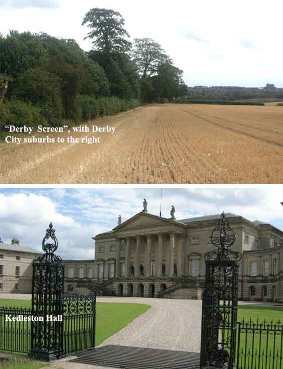
1. From the bus stop at the Mundy Arms, cross over the A52 to be on the same side of the road as the Farmhouse at Mackworth Hotel. Just past the hotel bear left onto the footpath marked as the Bonnie Prince Charles Way. Follow the footpath downhill to Lower Road. Cross over the road and continue on the footpath that runs between two houses and leads into open fields. Halfway across the first field, take the small footbridge on the left and continue on to the end of the field to cross another larger footbridge across the Mackworth Brook. Continue on the footpath which runs alongside the hedgerows of a further five fields until you reach the farm on your left. Bear right at the farm and walk along the farm track for about four hundred yards and, at the junction with another track running left to right, cross over the field and walk towards a gap in the woodland which forms part of the so-called Derby Screen which encloses the southern edge of Kedleston Hall’s parkland. The footpath continues through the gap in the woodland to cross over the middle of two fields. At the bottom of the second field take the footbridge over the Cutler Brook and continue into the next field with the hedgerow to your left. After about three hundred yards bear right and then left to follow the line of the hedgerow until you exit the field onto Kedleston Road.
The first part of the walk, the Bonnie Prince Charles Way, follows the general direction of Prince Charles Edward Stuart’s march from Ashbourne to Derby in 1745 in his failed attempt to seize the English crown. The Kedleston estate has been the seat of the Curzon family since at least 1297 and the present mansion, Kedleston Hall, was built for Sir Nathaniel Curzon in 1765. The Hall and the surrounding parkland is now a National Trust property. The woodland forming part of the southern perimeter of the parkland at Kedleston Hall, the so-called “Derby Screen”, was planted in 1960 by the Curzon family in an attempt to obscure the north western expansion of the city of Derby.
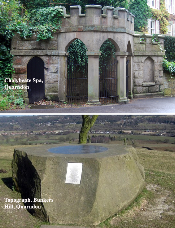
2. Cross straight over the road to pick up the footpath again and, with the Kedleston Country House in the distance on your left, walk to the bottom of the field where you will bear right into the next field. Continue on the footpath for about for hundred yards where you will exit onto the main road in the village of Quarndon. Turn left here and, passing the site of the 18th century Chalybeate spa, continue up the hill to the Joiner’s Arms. From the Joiner’s Arms walk up the hill to the centre of the village. At St Paul’s Church, bear left along The Common for about two hundred yards and then turn right into Coach Drive where you will see a footpath sign for Duffield via Bunkers Hill. About two hundred yards along Coach Drive, bear left onto Montpelier and, after a few more yards, take the footpath in the direction of Bunkers Hill. Walk along the path for about a third of a mile, passing woodland on your left, until you reach Bunkers Hill and the Millenium Topograph. At the topograph, bear left downhill and, about a hundred yards past the farm house, bear left again along the hedgerow. After about another two hundred yards, bear right across the field and follow the footpath across two more fields until you exit on the A6 main road on the outskirts of Duffield.
The “Chalybeate Wellhouse”, near the Joiners Arms at Quarndon, provided 18th and 19th century travellers with spring water infused with traces of iron that was described in 1811 as “…. a tonic producing a genial glow, improving digestion, and giving strength and tone to the whole system.” At nearby Kedleston Hall there were thermal springs more suited to bathing, being infused with sulphur rather than iron. The Kedleston Country House hotel, originally known as the New Inn, was built in 1762 by the Curzon family to accommodate visiters to Kedleston attracted by the thermal spring. Among those who sampled spa treatments at both Quarndon and Kedleston, were dictionary-maker Doctor Samuel Johnson in 1774, and the popular naval hero Admiral Rodney in 1787. Daniel Defoe, the author of Robinson Crusoe, sampled the water at Quarndon in 1727.
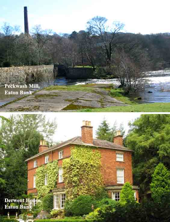
3. Cross the A6 and take the footpath directly in front of you, over two fields, until you reach the footbridge over the main railway line. Cross over the railway line into the car park of St Alkmunds Church and, just to the left of the church, take the footpath through the field to the River Derwent where you will bear left, along the river bank, until you reach the main road. Turn right here, over the bridge that crosses the River Derwent, and then bear right into Duffield Bank. Walk past the Bridge Inn on your right and, just past the entrance to the car park, take the footpath on the right. Continue along the footpath for about half a mile, walking parallel to the river, until you reach the old Peckwash Paper Mill. Continue on the footpath, passing the mill chimney, and then bear left walking past Derwent House and exit the footpath onto the main road. Turn right here and continue along the pavement for about a quarter. Just after the houses on the left-hand side of the road take the footpath that leads uphill into woodland. After about fifty yards bear left and continue uphill, past old quarry workings on your left, through the woodland until you exit onto Vicarage lane. Continue along the lane for about a quarter of a mile, past St Paul’s Church and into the centre of the village of Little Eaton. Buses for Ripley, Heanor and Derby stop on the main Afreton Road in Little Eaton.
The old Peckwash Paper Mill dates back to the 17th century. As early as the 13th century there was a corn mill on this site. The paper mill was rebuilt in the early 19th century and the waterwheels were removed in 1890 to be replaced by turbines and steam engines. In the early 20th century the mill was used for various other industries until falling out of use in the 1950s. The derelict building was converted to a residence in the 1990s. Derwent house is a Grade II listed structure originally built as the manager’s house for Peckwash Mill in the early 19th century.