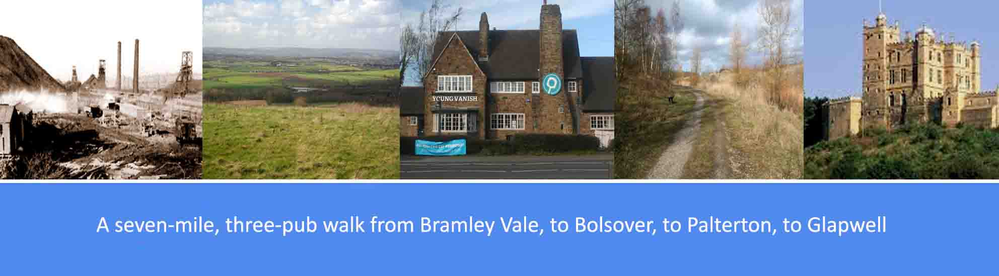
About this walk
The walk described below starts from the outskirts of Bramley Vale and Glapwell, going first along the Stockley trail to Bolsover, and then along the high ridge above the Doe Lea valley to the hamlet of Palterton, before finishing in the centre of Glapwell. However, the start and finish points are interchangeable, with excellent bus services from various locations in the area including Chesterfield, Mansfield and Nottingham.
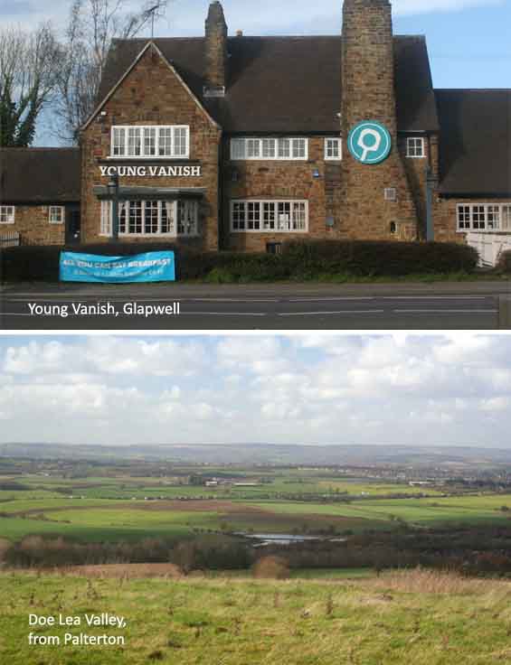
The overall route is just over seven miles over flat terrain, with the excption of the steep climb into Bolsover. There three pubs featured en route, fairly evenly spaced, serving good cask ales; so, at just over seven miles, it’s a comfortable three-pint walk, allowing you to arrive home calorie neutral and none the worse for wear. The pubs are: the Plug and Feathers on the outskirts of Glapwell; the Pillar of Rock at Bolsover; and the Young Vanish in the centre of Glapwell. Several other good pubs are available at Bolsover.
As well as the good ales, there are also along the way a number of points of historical interest. These include: the Stockley Trail built on a section of the now disused Doe Lea Branch Line railway that used to serve the local collieries; the Peter Fidler Reserve named after a famous map-maker, fur trader and explorer born in Bolsover; Bolsover Castle and the medieval earthworks in Bolsover.
Route Description
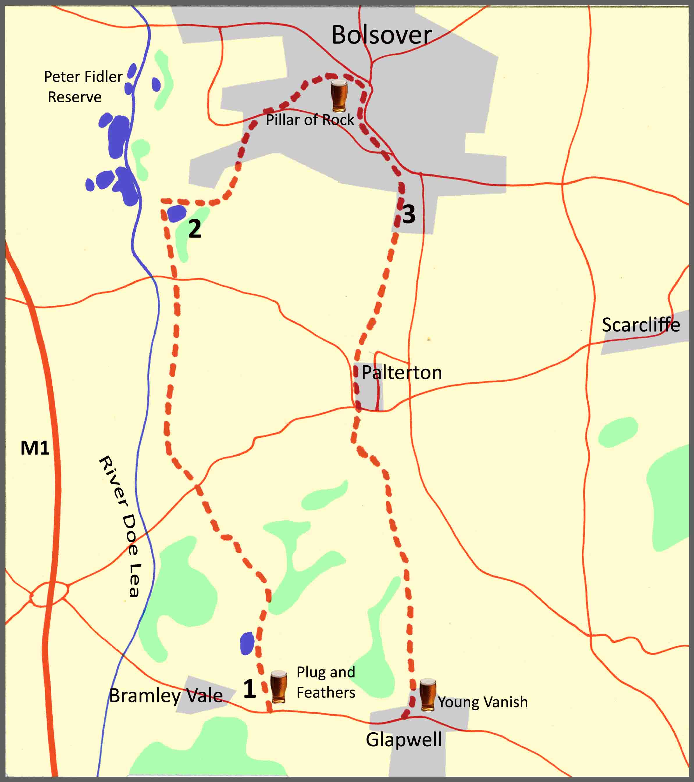
1. From the Plug and Feathers on the outskirts of Bramley Vale and Glapwell, turn right into Stockley Lane to join the Stockley Trail. A quarter of a mile along the Stockley Trail you will pass Stockley Pond on your left. A hundred and fifty yards after the pond, there is a fork in the trail. You can follow either fork since both branches of the trail join up a quarter of a mile further on. However, the right-hand fork follows the more scenic route along the valley floor and, if you follow this route, bear left at yet another fork in the trail some three hundred yards further on. A hundred yards on from where the two main trails join up, bear right and take the path across the metal footbridge over the Stockley Brook. Follow the path for just over a hundred yards and cross over a second footbridge after which you will bear sharp right to continue on the Stockley Trail running parallel to the Stockley Brook. Three hundred yards after the second footbridge, the Stockley Trail crosses a road, Rylah Hill. Continue on the Stockley Trail for just under a mile where you will cross Carr Lane. From Carr Lane, carry on the trail for a further six hundred yards and then take the footpath off to the right walking past the fishing pond, also on your right.
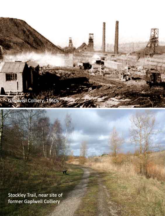
The Stockley Trail is a two mile multi-user trail between Glapwell and Bolsover and is maintained by Derbyshire County Council linking the Peter Fidler Reserve, Carr Vale Nature Reserve and the Glapwell countryside sites. The trail roughly follows part of the route of the once Doe Lea Branch Line, an eight and a half mile stretch of railway that used to serve the local collieries including those at Palterton, Glapwell, and Pleasley. Glapwell Colliery, which closed in 1974 after being in operation for almost a hundred years, was situated next to the Stockley trail not far from Glapwell railway station and the Plug and Feathers pub. The Peter Fidler Reserve is named after the eponymous map-maker, fur trader and explorer in what became Canada. Born in Bolsover, he lived most of his life in Canada where he married a Cree woman, a native American with whom he had 14 children.
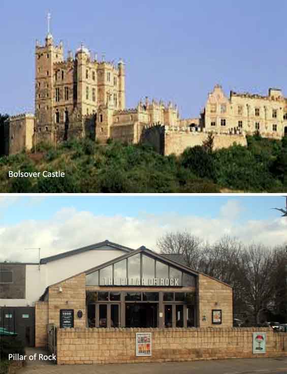
2. From the fishing pond, continue on the path into Water lane which will lead you past Sherward St and Bathurst Road into Carr Vale Road in Bolsover. Continue up Carr Vale Road to the roundabout where you will bear right into New Station Road. Just past Vale Care Home, bear left up Castle Lane. Walk up to the top of the hill where Castle Lane leads into Castle Street with Bolsover Castle and the Pillar of Rock Wetherspoons on the left. From the Pillar of Rock, continue along Castle Street into Bolsover town centre, walking past the Market square and bearing right into Town End. At the end of Town End, at the junction with Moor Lane, bear sharp right into Langwith Road. Cross over Langwith Road and bear left onto the footpath along the earthworks that takes the corner off the Langwith Road. At the end of the footpath, re-join Langwith road and continue down, past New Station Road on your right and, as Langwith Road bends to the left, bear right into Darwood Lane. After a hundred yards, where Darwood Lane goes sharply downhill to the right, bear left and walk towards the house straight ahead of you and take the footpath to the left of the house.
Bolsover Castle was built in the early 17th century by the Cavendish family from the ruins of a medieval castle founded in the 12th century by the Peverel family. During the Civil War, it was surrendered to Parliamentarian troops who left it in a ruinous state. Following the reformation of the Monarchy in 1660, Sir William Cavendish returned to England from exile to manage the castle’s restoration and expansion. In the 19th century the castle passed into the Bentinck family where it ultimately became one of the seats of the Dukes of Portland. From 1883, Bolsover Castle remained uninhabited and was eventually given to the state by the 7th Duke of Portland in 1945 and it is now in the care of the English Heritage. The earthworks near Langwith Road in Bolsover are surviving medieval ‘ditch and bank’ entrenchments, believed possibly to date from about the 13th century.
3. From Darwood Lane, walk for just over a quarter of a mile between hedgerows until you reach open fields and a clear view of the Doe Lea Valley on your right. Continue on the footpath over the fields for six hundred yards and take the right fork in the footpath towards the buildings which will be on your left. After a further three hundred yards on the footpath you will reach the road that leads into Main Street in the village of Palterton. Continue through the village until you reach a junction of Rylah Hill and Main Street. Cross over the junction and enter the lane signposted to Glapwell and Scarcliffe. At the end of the lane, follow the footpath along the edge of the field. At the top of the field take the wooden gate at the right-hand edge of the field and follow the footpath along the hedgerow in the next field. After seven hundred yards along the hedgerow, follow the footpath across the middle of the next two fields towards a group of farm buildings. Walk past the farm buildings and take the alley between the houses to enter The Pinfold road in the village of Glapwell. At the bottom of The Pinfold, bear right and walk to the main road, the A617, where you will turn left, up the hill, to the Young Vanish pub on the main bus route to Mansfield and Chesterfield.
Palterton is a hamlet within the parish of Scarcliffe, sometimes referred to as ‘Scarcliffe with Palterton’, and it is a mile to the west of the main village of Scarcliffe. The population of the Scarcliffe parish, including the main village and the hamlets of Palterton, Rylah, Stockley, and parts of Stony Houghton and Hillstown (Bolsover), is just over five thousand. Palterton is recorded in 1086 in the Domesday Book under the land of Ralph Fitzhubert. Palterton once had a railway station, Palterton & Sutton, on the Doe Lea Valley Line from Staveley to Pleasley. It was opened in September 1890 by the Midland Railway, later part of the LMS, and it closed to passengers in September 1930. Scarcliffe railway station opened in 1897 by the Lancashire, Derbyshire and East Coast Railway, later becoming part of the Great Central Railway and subsequently the LNER, and it closed in 1951.