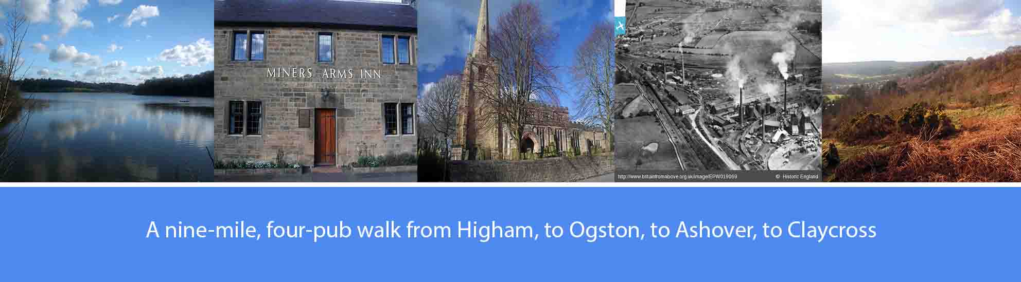
About this walk
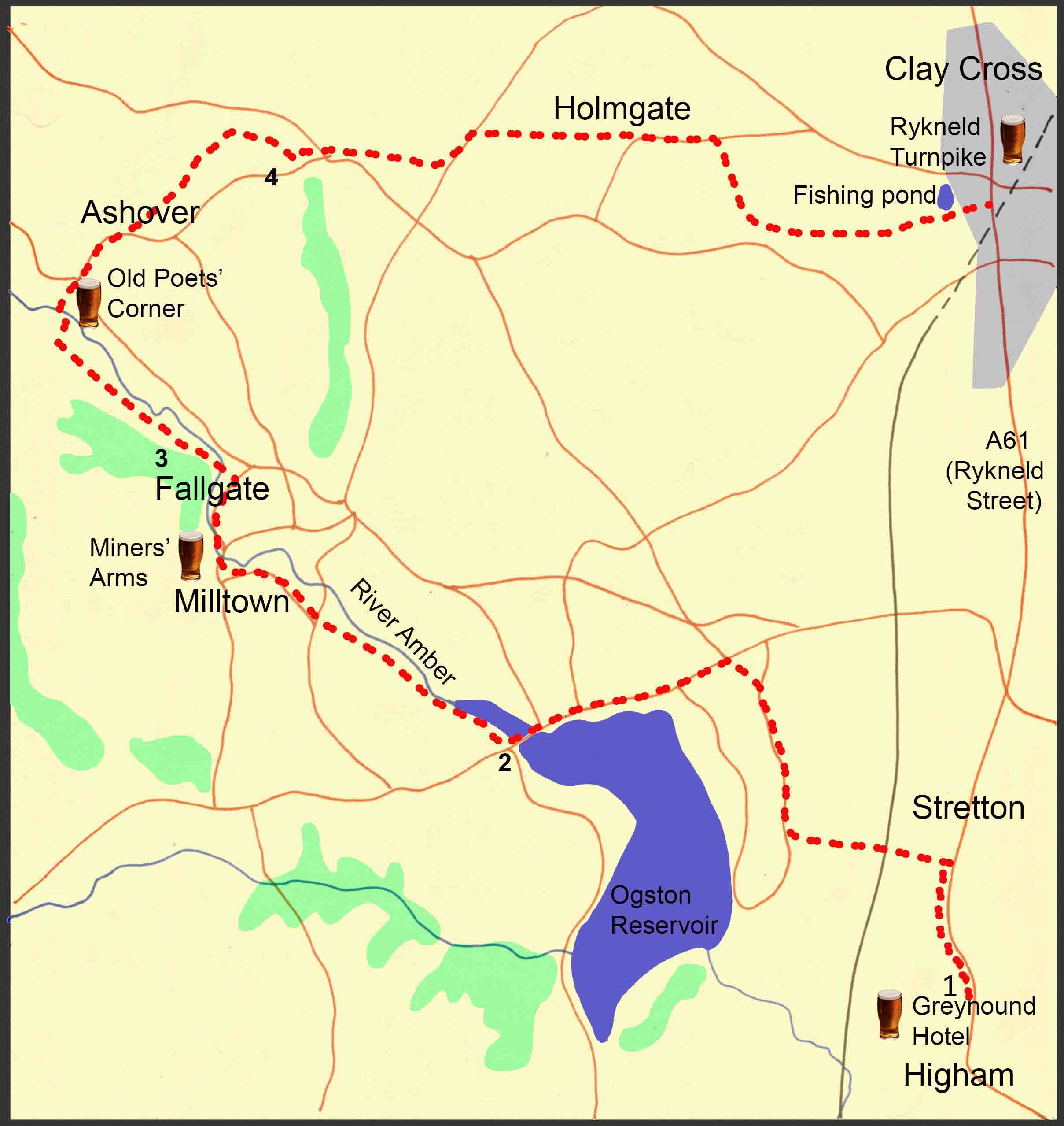
The walk described below starts from the Greyhound Hotel on the main A61 at Higham, and passes along Ogston Reservoir, through Ashover and then finishes at Clay Cross. However, the start and finish points are interchangeable, with both sited on the A61 and the route of a good bus service connecting Chesterfield, Alfreton, Ripley and Derby.
The overall route covers just under nine miles with some easy sections that follow parts of the line of the now defunct Ashover Light Railway; however, elsewhere on the route there are also some fairly steep hill sections. There are four pubs featured en-route, serving good cask ales; so, at just under nine miles, it’s a comfortable four-pint walk, allowing you to arrive home calorie neutral and none the worse for wear. The pubs are: The Greyhound Hotel at Higham; the Miners Arms at Milltown; the Old Poets Corner at Ashover; and the Rykneld Turnpike at Claycross. Several other good pubs are available at Ashover and Claycross..
As well as the good ale, there are also along the way a number of points of historical interest. These include: the creation of Ogston Reservoir; the limestone and fluorspar quarries around Ashover; the now defunct Ashover Light Railway that transported the limestone and fluorspar to ironworks at Clay Cross to Ashover; George Stephenson’s role in the development of heavy industry at Clay Cross; and Rykneld Street, the old Roman road following the line of the A61.
The route description
1. From the Greyhound Hotel, walk along the A61 in the Claycross direction for just over half a mile. Then, take the footpath off to your left which leads steeply downhill towards the main railway line that runs along the bottom of the valley, north to south. At the bottom of the valley, walk through a small wooded area and cross over the railway line over the footbridge. Walk over the service road that provides access to the water treatment works at Ogston, and continue straight up the other side of the valley until you meet a single track road. Turn right at the single track road and continue along it for approximately a quarter of a mile where you find a footpath marker taking you off to the left. Follow the footpath, across the field, until it meets the B614 road. Turn left onto the B614 and continue on the road for approximately a quarter of a mile where, at the bottom of the hill, the northern end of Ogston Reservoir will come into sight. Continue along the road, with the reservoir on your left, passing over the bridge which crosses the River Amber as it feeds into the reservoir.
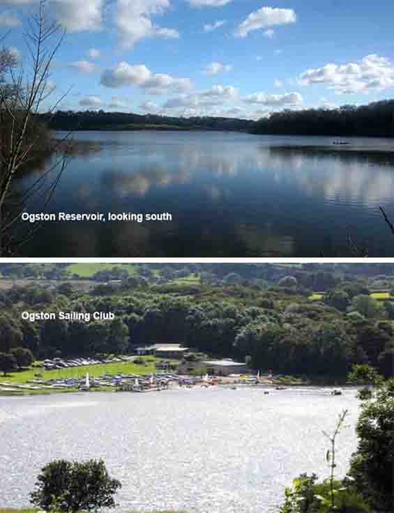
Ogston Reservoir was originally created in 1958 to supply the National Coal Board’s Carbonisation and Chemical Plant at nearby Wingerworth. The damming of the valley allowed water from the River Amber to flood farmland, roads, part of the disused Ashover Light Railway and most of the village of Woolley. Villagers were relocated into council houses built in another local hamlet, Badger Lane, which eventually became known as the present village of Woolley Moor. The reservoir holds approximately 1300 million gallons of water and is run by Severn Trent Water to supply the local area and to provide holding water for nearby Carsington Reservoir. It is the home of Ogston Sailing Club and Ogston Bird Club, one of the largest bird clubs in Britain.
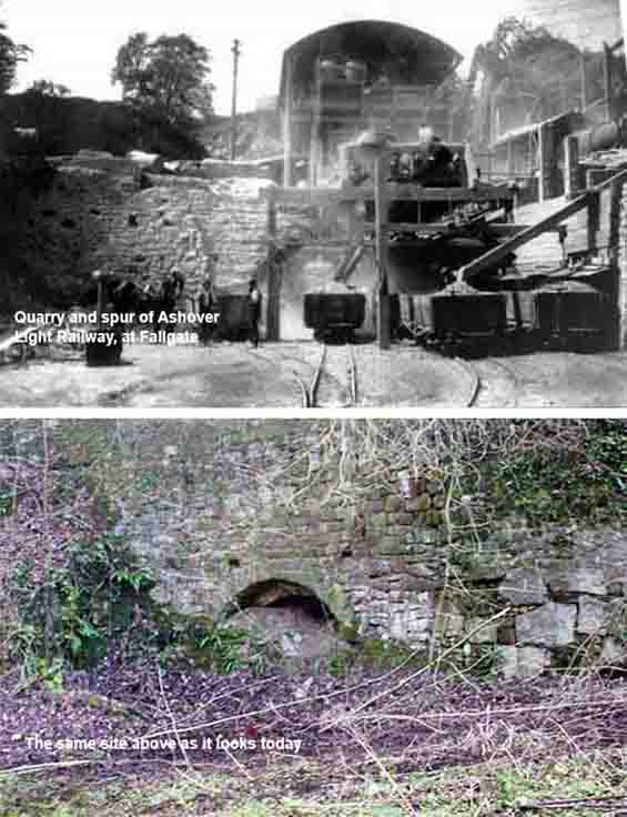
The Ashover Light Railway was built by the Clay Cross Company to transport minerals, chiefly limestone, fluorite and gritstone, from quarries around Ashover to its works at Clay Cross. Construction started in 1922 with the railway opening to goods traffic in 1924 and to passenger traffic in 1925. The narrow gauge line and rolling stock were built using First World War surplus equipment from the War Department Light Railways. All passenger services were withdrawn in 1936 and, although mineral traffic continued, the railway declined through the 1940s finally closing in 1950. To avoid tunnelling, the line made a detour south, from Clay Cross, before turning westwards towards Ashover crossing the now flooded valley at Ogston.
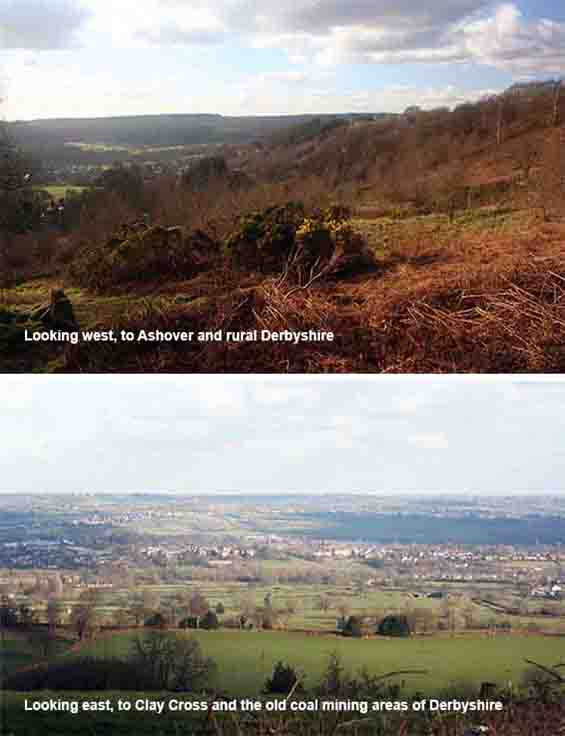
The top of the ridge provides an excellent vantage point to appreciate the many differences between the area of Derbyshire from Ashover and further west, and the area to the east, to Clay Cross and beyond. The ridge above Ashover is part of a seam of millstone grit, forced upwards by volcanic activity millions of years ago, and exposed to form the dramatic landscape of the so-called ‘dark peak’. To the east, the landscape is flatter and less dramatic, containing the old coal fields and iron ore deposits of the more industrialised part of Derbyshire. This geological distinction not only explains the different landscape and scenery of the areas to the east and to the west, but it also explains much of their differences in demographics, economy and culture.
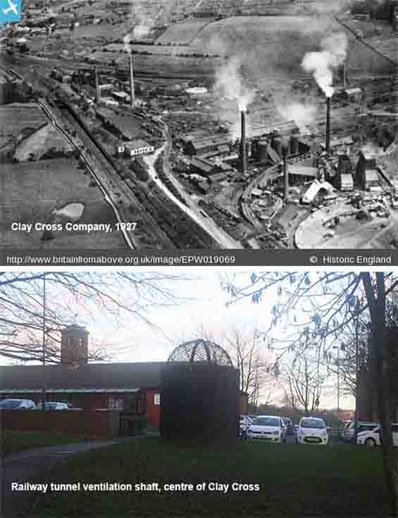
In the early nineteenth century, Clay Cross was a small village, and it wasn’t until the Derby to Leeds railway was built in the 1830s that it began to develop as an important industrial town. Whilst driving the railway tunnel underneath Clay Cross, George Stephenson discovered rich deposits of coal and iron ore which, together with the demand for limestone, prompted him to set up business as George Stephenson and Co, later known as the Clay Cross Company. The company ran its own collieries, brickworks and iron works and built hundreds of houses for families who were attracted to work and live in the town. The company continued to develop into the twentieth century but, following the rationalisation of heavy industries in the latter part of the century, it finally closed in 1998 with much of the land it once occupied now turned over to small, light-industry units.